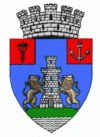
Turnu Măgurele (Turnu Măgurele)
 |
The first documentary attestation of the town appears in a diploma issued by Sigismund of Luxembourg, king of Hungary, on the occasion of the battles fought here in 1394. The fortress belonged to the Ottoman Empire, intermittently, between the years 1417-1829, being a turkish raya. During the Iancu Jianu's hajduk raids against the Vidin pasha Osman Pazvantoglu, the fortress was burned and destroyed. After the Russo-Turkish war of 1828-1829, the town became part of Wallachia, as a result of the Treaty of Adrianople. After 1829 the locality is relocated on the nearby hill, near the localities of Odaia and Măgurele, and the fortress is demolished. From 1839 it was the residence of Teleorman county until 1950 and once again from 1952 until 1968, when, following the administrative reorganization, it loses the status of county residence in favor of the city of Alexandria.
The communist urban systematization had a major impact on the town's urban planning and the establishment of the Chemical Fertilizer Plant (1962) transformed the city into an industrial one. Forced urbanization caused the city's population to grow substantially to reach almost 37,000 in 1992.
After the 1989 Revolution, the municipality suffered a sharp decline as a result of the collapse of industrial and economic activities and the migration of the population to the larger cities as well as to other European states.
A ferry plies across the Danube to the Bulgarian city of Nikopol. There are some vestiges of a Roman bridge across the Danube, built in 330 by Constantine the Great. It is built in the Danube plain in a fertile land called Burnas plain. At 4 km south-west from it the river Olt joins the Danube. Its medium altitude is 31 m above sea level.
Map - Turnu Măgurele (Turnu Măgurele)
Map
Country - Romania
 |
 |
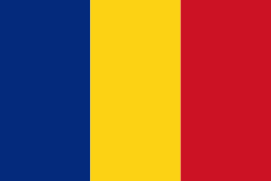
| Flag of Romania | |
Europe's second-longest river, the Danube, rises in Germany's Black Forest and flows southeasterly for 2857 km, before emptying into Romania's Danube Delta. The Carpathian Mountains cross Romania from the north to the southwest and include Moldoveanu Peak, at an altitude of 2544 m.
Currency / Language
| ISO | Currency | Symbol | Significant figures |
|---|---|---|---|
| RON | Romanian leu | lei | 2 |
| ISO | Language |
|---|---|
| HU | Hungarian language |
| RO | Romanian language |


